2022 Erie Canal Tour: Wrap-Up

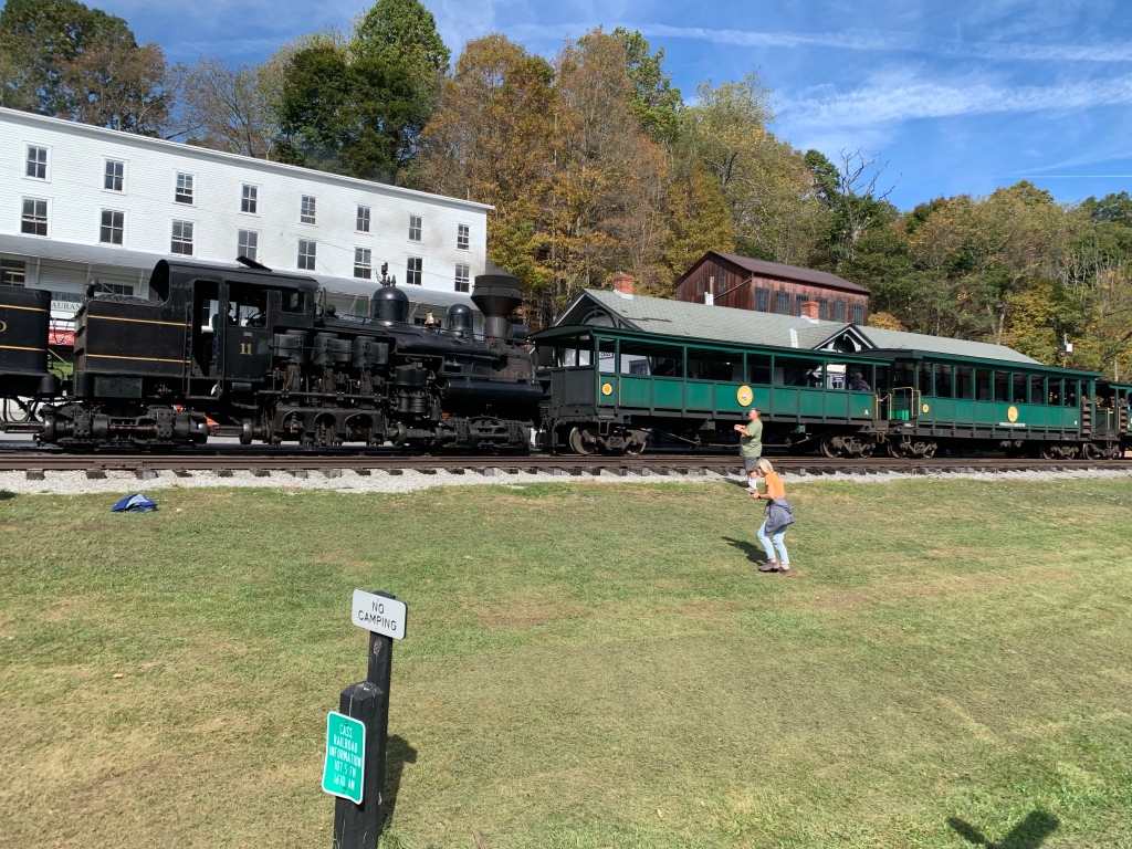
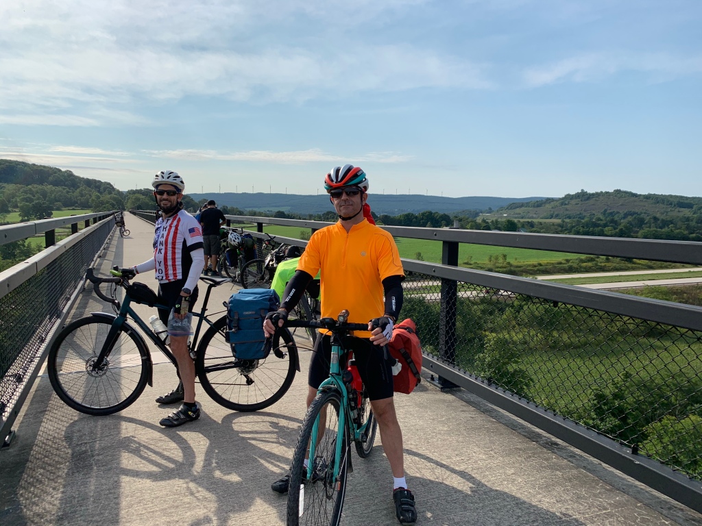
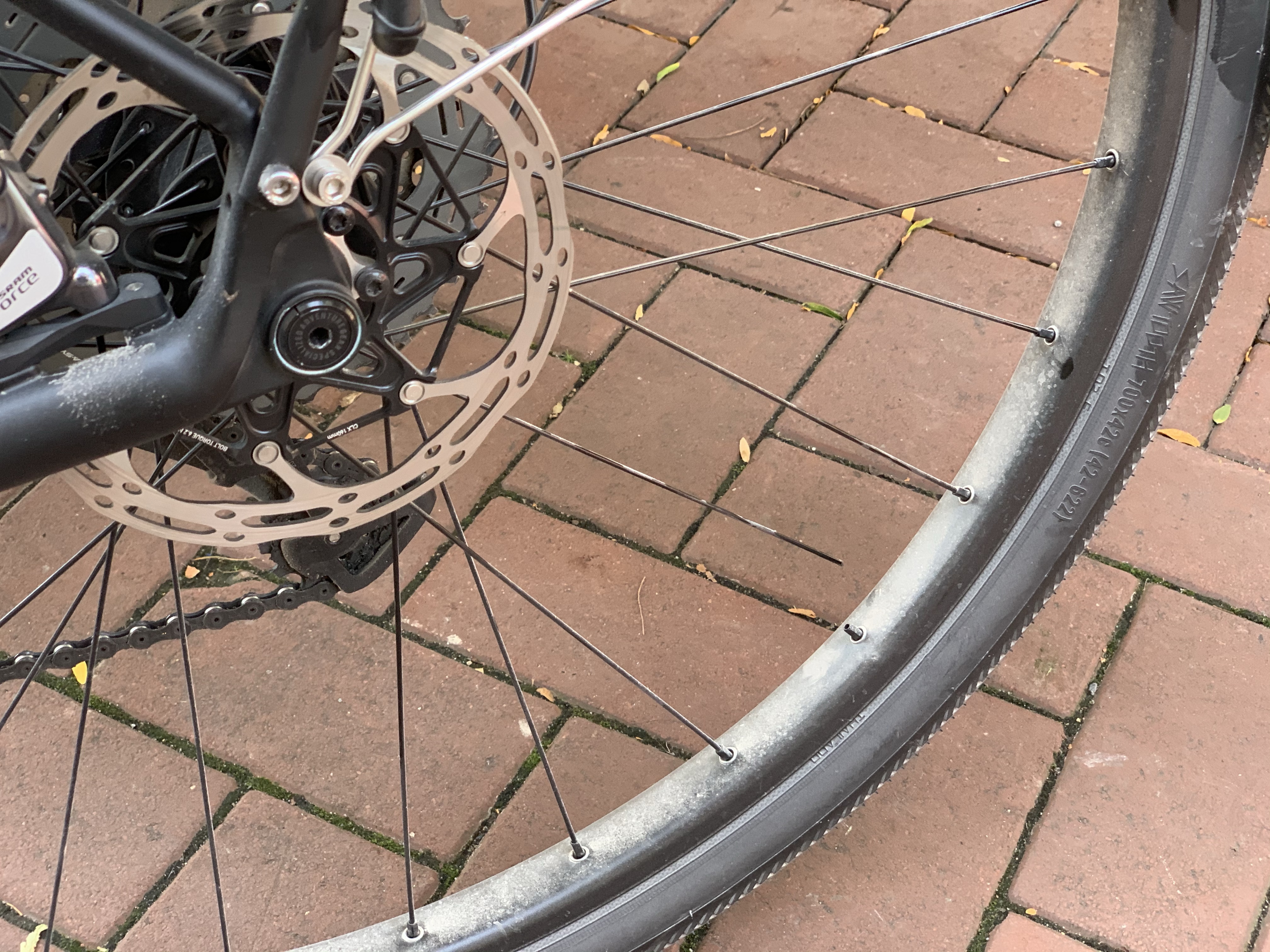
The 2022 Cycling Adventure on the Erie Canal is complete. Zubby, JB, and I had a great trip along the canal route. Even with some equipment issues (darned broken spokes!) and a little downtime helping Zubby de-bonk, it was fun. This was the worst weather I’ve done a bike tour in: 5 of 7 days in some amount of rain. Again, none of those issues detracted too much from a great week of unplugging on two wheels.

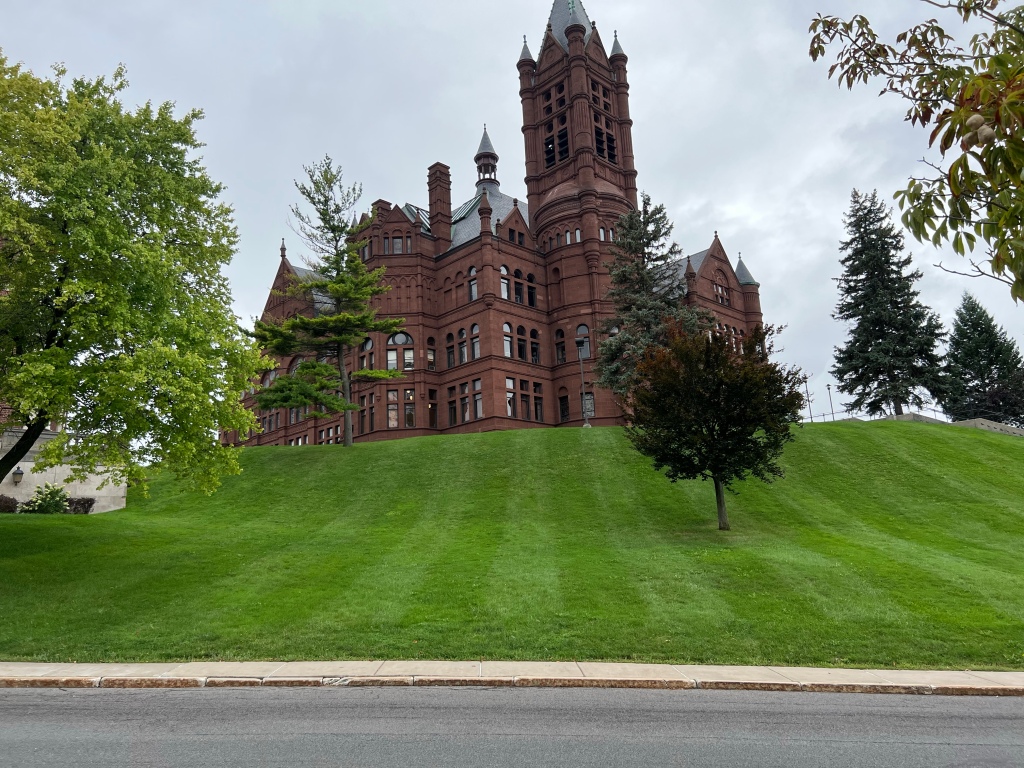
Touring with other people is good because you can watch over each other. It also brings along some tradeoffs. You have to compromise and decide when to do side trips, where to eat, and so on. I think this tour worked out very well and we did a good job of helping each other along. I enjoyed JB’s wanderlust that took us into the little towns along the way and the excursion through Syracuse to see the university and some of the local sights. Zubby is an eternal optimist who found a way to enjoy the trip even in the rain. My only regret is that we couldn’t somehow change our itinerary to accommodate Billy’s family covid situation. We’ll just have to get another option planned for 2023!

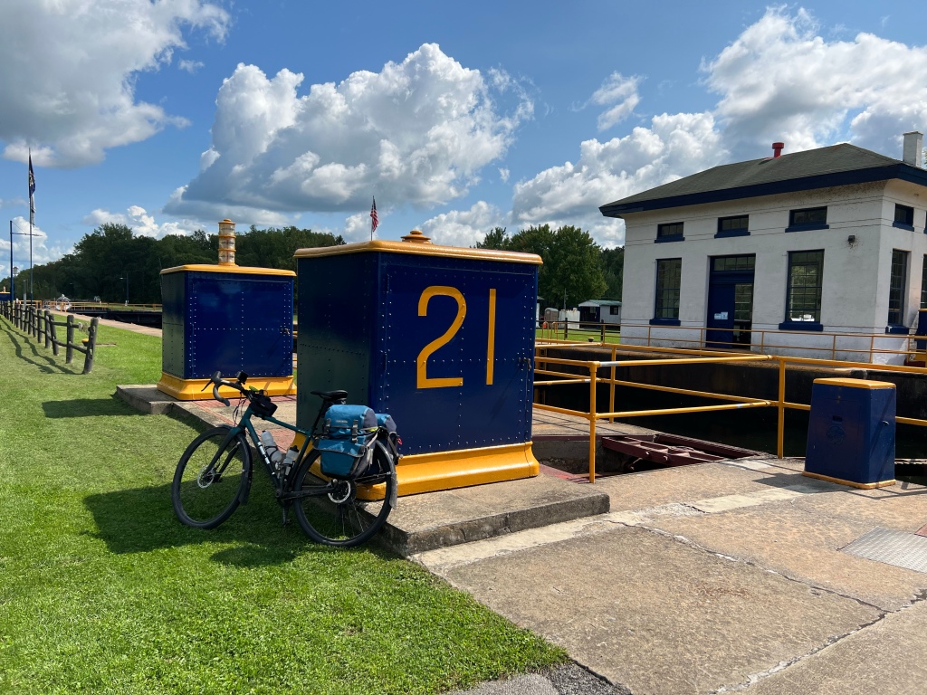
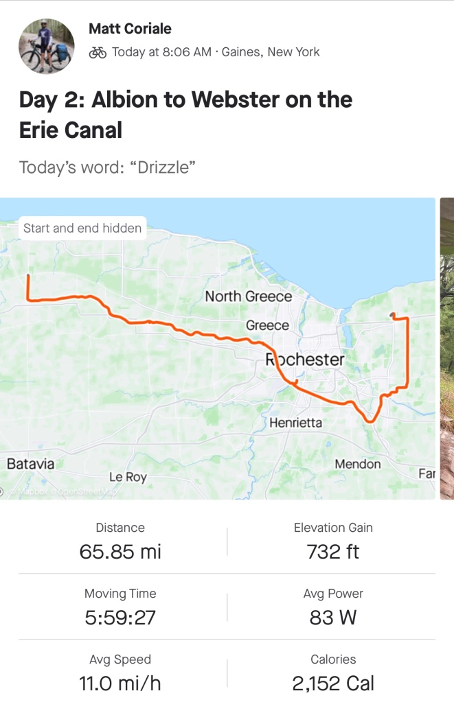
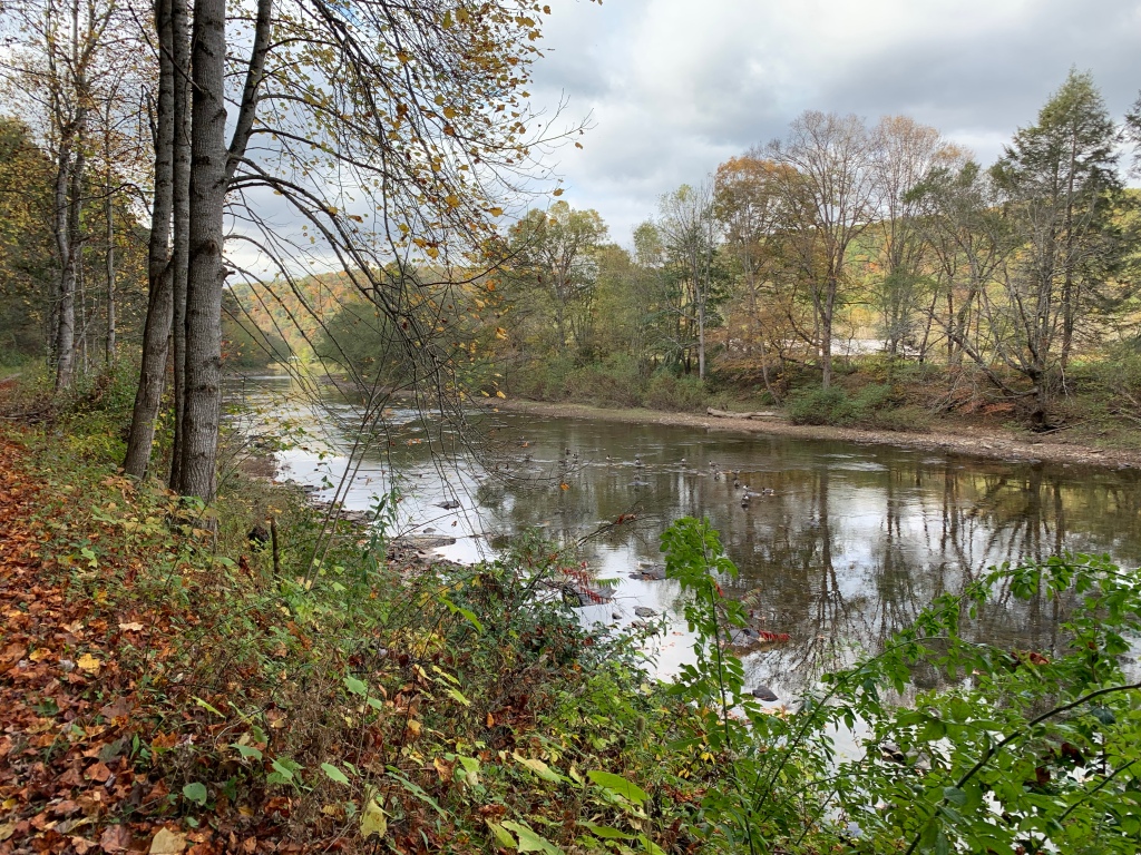
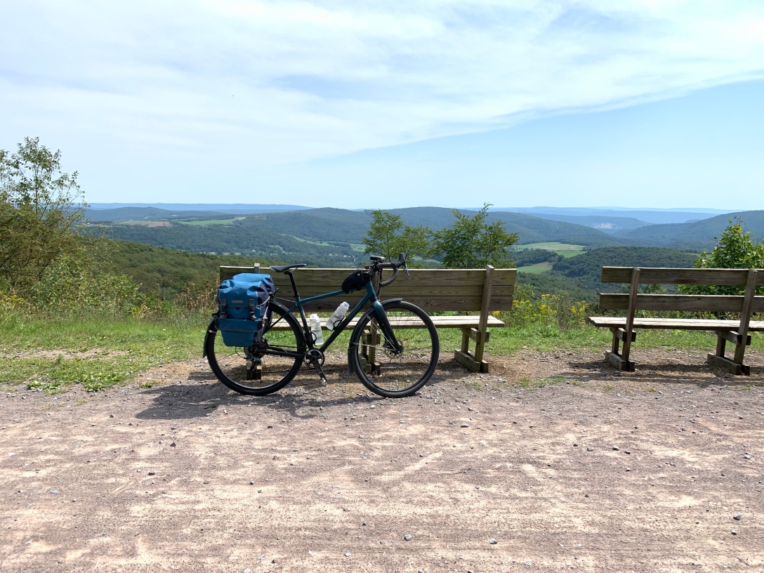
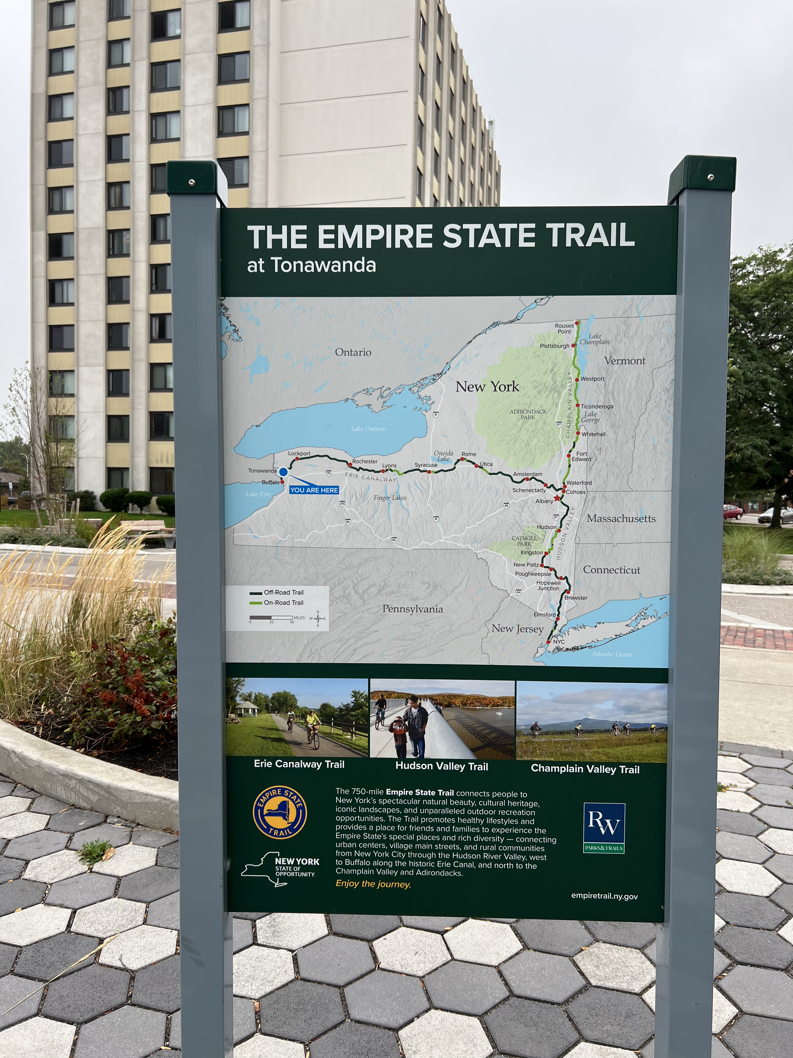
As I collect my wrap-up thoughts, first I’ll give my impression of touring the Erie Canal. It is one of the better developed touring routes in the United States. At about 400 miles from Buffalo to Albany, it provides a long ride with reasonably spaced towns for accommodations. Most of the route is on dedicated path, with some through-city parts on bike lanes or dedicated paths. There are a few stretches of on-road riding. The road sections were usually on either very quiet roads or on roads with generous shoulders. As an experienced road-rider, I didn’t feel too stressed by the road sections. If I were riding with young kids though, I would try to time the road sections for non busy times.

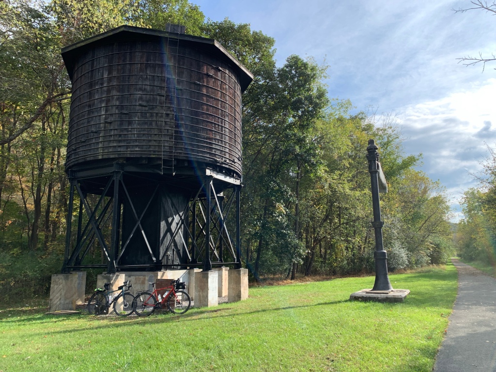
The surface for the path is a combination of paved and crushed limestone “stone dust” on top of packed dirt. I definitely prefer the paved parts, but the stone dust surface rides well when dry and drained well when it was raining. I recommend having tires with a little bit of width and tread in case it rains. The mud is slippery when wet.

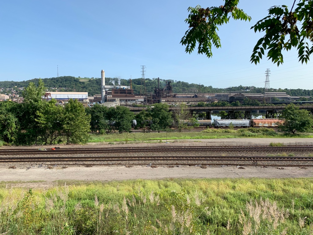
The route of the Erie Canal Trail is good. Starting in Buffalo, then Lockport and all of the port towns west of Fairport provide some good variety of things to see. Some of the towns are too small to support restaurants, but others are great places to get food and water. Once you get east of Fairport, the towns are more sparse, with the exceptions of the bigger cities like Syracuse, Rome, Utica, Amsterdam, Schenectady, and Albany.

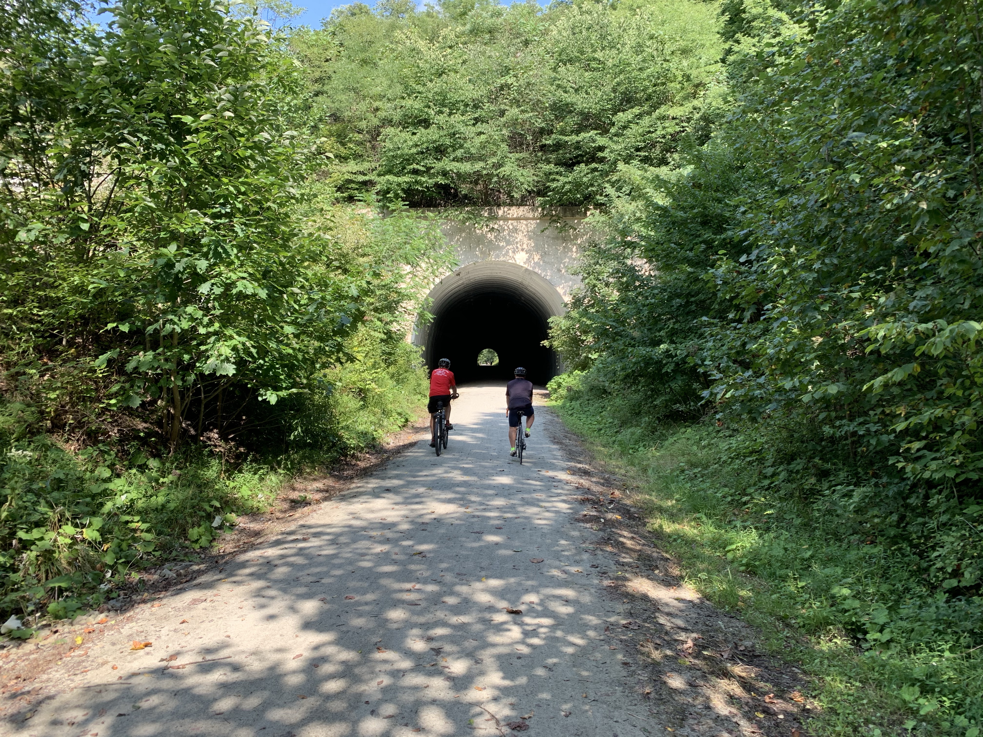
If I had to rank the Erie Canal Trail among other routes I’ve done, I’d put it in the middle. Definitely worth doing, but I prefer the scenery of the Great Allegheny Passage and the nearly all-paved Ohio To Erie trail is hard to beat. The Parks and Trails NY team does good job of marking the trail. There were only a couple of places where it wasn’t exactly clear where to turn. I had put together .GPX files for my Garmin to help and only used them in a couple of places. I have mixed feelings about the guidebook from the PTNY. It is useful but I think there should be a bit more detail with road names, especially in the Syracuse area. I do recommend buying it to carry with you, but don’t expect it to answer all of your routing questions.

We chose to do 7 days to minimize work vacation days. This pushed us to 65+ days 4 of the 7 days. I typically plan for ~60 miles when touring on my own and find that comfortable. I think this trip would have been better with shorter days. 50-60 mile days would have allowed for more sight seeing and accommodating mechanical and health issues.

If you’re new to bike touring, the Erie Canal Trail, or even just part of it, would be a good option to get started. It is gentle enough for medium-skilled riders and has enough scenery to keep it interesting.

Here’s a little bit about my equipment. Over time my cycling rig has evolved a bit. Here’s what I use today:

  • Bicycle: 2018 Specialized Sequoia Expert. I bought this bike at the end of 2018 and have been using it for touring since then. It is a good combination of robust build, comfort, and gearing. If I were to go cross country with lots of mountains, I might look for something with a wider gearing. I like that the frame has many braze-on lugs to easily accommodate a rack, fenders, and still have room for three water bottles. I don’t use the front lugs but could mount front racks if I wanted to carry more gear. I’m also a huge fan of disc brakes. This model has hydraulic brakes that are strong and sure no matter how wet they get.
  • Bike Add-Ons: I insist on fenders for touring. The rain and mud create quite a mess. I did two tours without fenders in 2010 and 2012 and will never do that again. I use a Blackburn rack, but I don’t know what model it is. I recommend one where the sides are long/wide to provide more support to your panniers and keep them out of your wheel area.
  • Tires: This is an area of passionate debate for cycle touring. I am a fan of Schwalbe touring tires, like the marathon plus. However this bike came with Specialized Adventure Gear Sawthooth 700x42mm tires. I’m still running the original Specialized tires and I’ve been very happy with them. They are a great tradeoff of tread for mud vs. rolling on smooth roads. I’ve got several thousand miles on them and only one flat. The tread is still in great shape, too. I will probably try to get similar tires again when it is time to replace these.
  • GPS: I have been using a dedicated bike GPS for many years. I currently use a Garmin Edge 820. I have a love/hate relationship with this device. For general ride tracking it does a sufficient job. For route guidance, I’d give it a “C” grade: I’ve needed to plot unknown courses like getting to the Rome bike shop and it does an OK job. However it is very slow when loading a premade .GPX files and the battery life is not great. I had to carry a spare battery pack with me and used it every day to charge up along the route. Garmin wants a ton of $ to replace the battery. Not gonna happen. I think when it is time to replace, I will look at a competitor’s unit such as Wahoo.
  • Bike Radar: Ok, this has become an essential piece of gear for me. I use a Garmin Varia RTL515 radar. This little device mounts on the back of the bike and has two purposes: 1) it is a brightly flashing tail light to get motorists’ attention, and 2) it tracks cars coming from behind and tells me where they are, how many are approaching, and how fast. This is displayed on my bike GPS screen. I really like knowing when a car is approaching. So I have both a rear mirror on my handlebar and this radar. I won’t ride without them at this point.
  • Panniers: Panniers are the bags that hook into the racks of the bike, kind of like bike luggage. I use Ortlieb “Bike Packer Plus” panniers. They are waterproof and have served me very well. They’re not cheap, but if you do a bunch of bike travel, you will find that you never have to worry about the contents getting wet with Ortlieb panniers. They also have a good rack-mounting system that locks the bags securely to the rack. There are many good and cheaper options out there, so if you’re just getting started, I suggest starting with a cheaper option and just pack your clothes in dry bags inside the panniers.
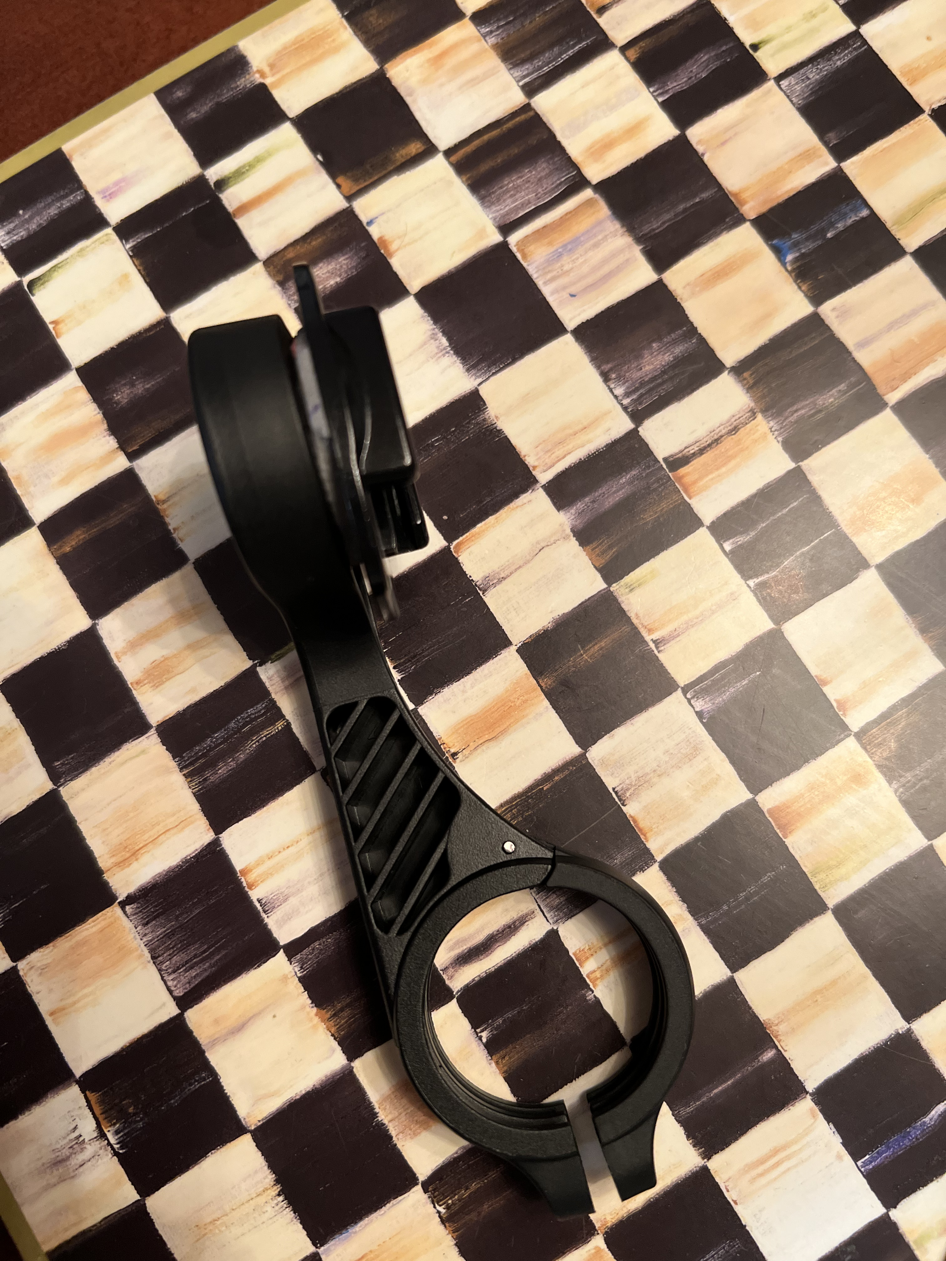
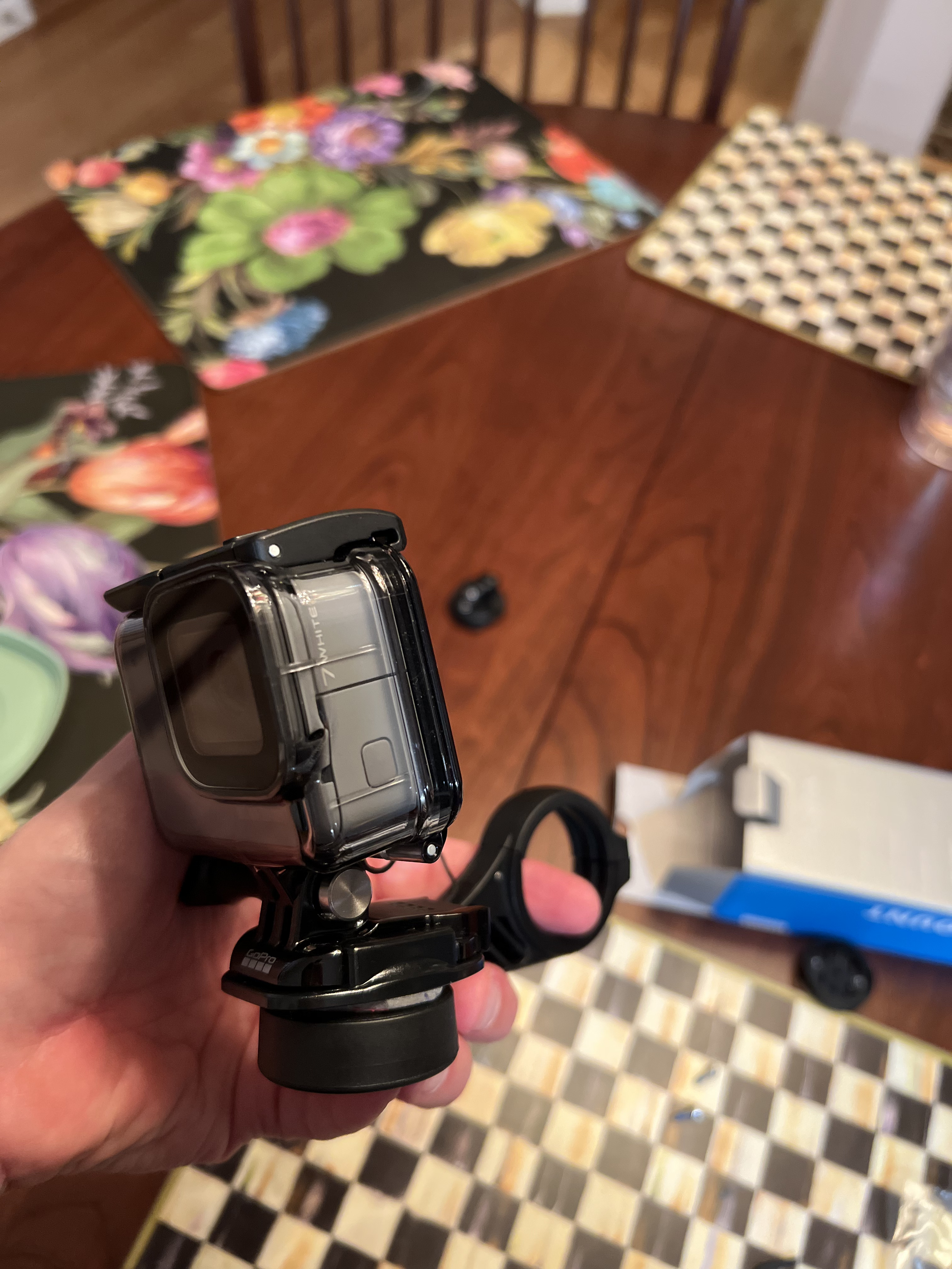
  • Camera: I purchased a GoPro Hero 7 on sale a couple of years ago so that I can take pictures while riding and not have to stop. I also have a love/hate relationship with this device. Somehow it manages to take pictures sometimes and videos others. I need to sit with some YouTube instructions to see the best way to operate it so that I can get pictures with my GoPro consistently. In the past, I have struggled to find a great way to mount the GoPro to my bike and think I cracked the code this time. I bought a well-reviewed off-brand Garmin style GPS mount, took the quarter turn off of it, flipped it upside down and used a genuine GoPro foam-tape mount to mount on the backside. It worked like a champ and allows me to remove the GoPro when I go into a restaurant. I’m really surprised nobody sells something like this pre-made. See my picture below for the mount. For my off-the-bike pictures, I use my iPhone. It takes great pictures.
  • Headlight: I have a rule to always carry a headlight. They tend to be heavy, but if you get stuck after sundown, it is really necessary. You can’t plan emergencies, but you can be prepared for them. I got stuck after sundown on the KATY trail a few years ago and will always keep a light with me now. I carry a Blackburn Central 300. It is bright enough to navigate with, but I’d recommend going even higher than 300 lumens if you can afford it.
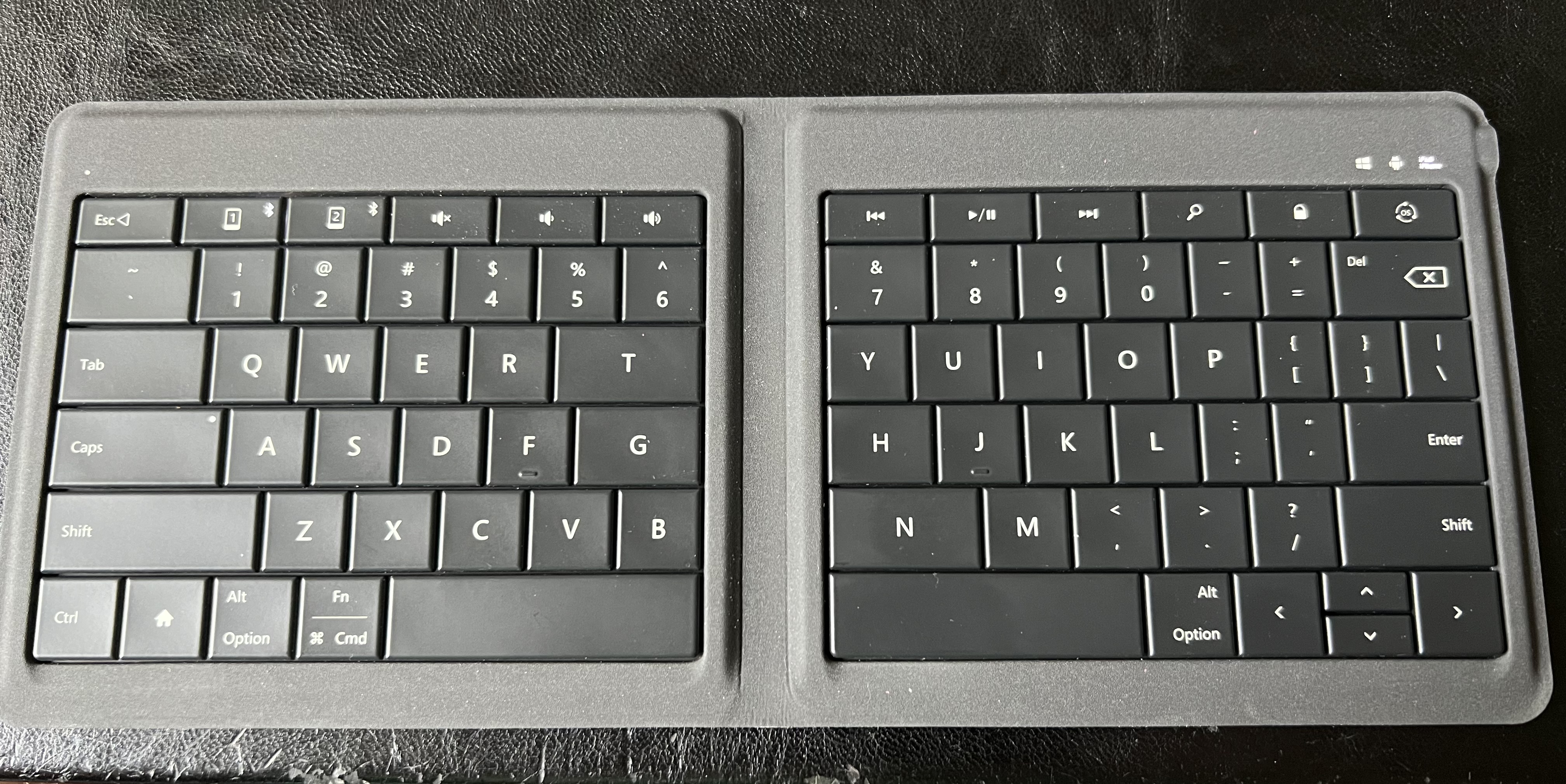
  • Blogging Setup: I use a small Microsoft bluetooth keyboard that folds up. It works with my iPhone and allows me to touch-type at full speed. It doesn’t weigh much and takes nearly no space in my bag. I use the WordPress dedicated iOS app on the phone. You probably found some typos in the blog. I’m not trying to write a novel, so I am not quite as careful when blogging.

Thanks for following along. I always enjoy hearing from people who read the blog or ask questions that I can help with.

Here’s a link to each of the day’s blog:

This is my last big 2022 bike adventure. I’m already looking forward to 2023 and another grand time on two wheels. Not sure where I’ll ride next, but I’m already daydreaming of options.

Until then, Peace.
— Dcn. Matt

2022 Erie Canal Tour: Days 6&7 – Utica to Amsterdam, Amsterdam to Albany. Done!

I was much too tired yesterday to blog. And honestly, I am again today, but if I don’t get my notes down now, it probably won’t happen.

Friday, day 6, was an eventful day for our band of three. We left Utica early under a bit of a fog. The weather was cool but nice. No rain, and that was most welcome.

It didn’t take long for the sun to dry up the fog and make for a beautiful and sunny day. We made a steady pace as we pedaled east. We stopped at several of the locks for a rest or pictures. Right about lock 18, we decided to watch a boat lock through.

The boat is named “Spontaneous”. We struck up a couple of minutes of conversation as they locked through. This couple was on their way to New Hampshire to deliver this boat to new owners. They have had some great adventures but just didn’t have the time to enjoy it any longer. We all decided that a great way to do this trip would be to cycle to one end and have a very relaxing boat ride back. It takes several days to travel the length of the canal by boat. They are restricted to low speed, so it is a relaxed pace.

As we began the day, Zubby just didn’t quite seem to be feeling 100%. By the time we reached the town of Canajoharie, he really didn’t feel well. Looking back, we think he “bonked” – a term that means you’re too low on calories and/or electrolytes and/or fluids. The brain just shuts you down. We got him into a local restaurant and he sipped a bunch of drink and cooled down. We hung out for about two hours. We had about 25 miles left to go, but Zubby decided he was done for the day. After a few unsuccessful attempts at Ubering and Lyfting, we got ahold of someone who was able to drive him forward to our hotel in Amsterdam.

So then there were two…

JB and I pressed on to Amsterdam without much further excitement. We stopped for a few minutes at the entrance to the shrine for the North American Martyrs. This is the site of the 17th Century Mohawk Village of Ossernenon, birthplace of St. Kateri Tekakwitha, and the site of martyrdom for three Jesuit missionaries. This particular shrine has importance for me because of some time spent here back in 2010 with my daughter and wife. We were running quite late after helping Zubby so we couldn’t stay long.

We finished our ride and arrived at the Castle in Amsterdam NY. This is an old armory that has been converted into a castle-themed hotel. It was a very fun place to stay and we enjoyed it very much.

x

So that was the end of day 6. We all regrouped at the hotel. JB and I enjoyed a wonderful dinner at a local Italian place, Lorenzo’s.

That brings us to today. Last night, Zubby decided he was done for the trip. We had about another 45-50 miles to the end and he didn’t think it was good to continue. So we rearranged his Amtrak ticket so that he would stay in Amsterdam while JB and I finished the trek to Albany.

It was another fantastic, dare I say epic, weather day. Blue skies, temps in the low 80s and no headwinds. Can’t ask for better.

We decided that we wanted to try to find some donuts today. That was high on JB’s list. So we had a light breakfast at the hotel and then decided we would try to find some pastries or donuts in Schenectady. We eventually found a Dunkin’ Donuts and we split a half-dozen donuts between us. They went down really fast.

As we were making our way east, I saw a boat in the distance that looked familiar. We reached to the next lock, and sure enough, it was “Spontaneous” again. We had seen them yesterday and now again today. We said Hi to the owners and then went on our way.

The trail in Schenectady has some ups and downs to it. It diverges from the Mohawk river up and overlooks it, then goes back down to meet the river again. Felt good to do a little gentle climbing after so much flat riding.

The last few miles were uneventful, except that my Garmin had not been tracking my distance from when we left breakfast in Schenectady until we reached the northern part of Cohoes. Annoying. The track made it look like I was able to magically fly across the county.

We arrived in Albany with plenty of time to spare. We had to be at the Amtrak station on the other side of the Hudson by 3:00PM. So we went in search of food and drink. We found great little pub. I had a beer and a fish fry. It was extra delicious today.

After lunch, we made a quick trip over the Hudson to the town of Rensselaer. It was very easy to cross the bridge because it has a dedicated bike / pedestrian area away from traffic.

The Amtrak station in Albany is clean and nice. I took the opportunity to change out of my stinky riding clothes and into some street clothes for the ride home. JB did the same. We boarded the train without too much difficulty. Zubby had a ticket for the same train, departing from Amsterdam.

I had been warned that the Amtrak Empire Service could not handle very many bikes. We had pre-arranged and paid for shipping our 3 (4 originally) bikes. The process for loading was to let the conductor tell us which car had a rack open. We then wheeled the bikes in and hung them in the rack. Not too bad, but not nearly as convenient as the entire bike-friendly train car that I rode from Pittsburgh to DC a few years ago.

I got off the train in Rochester and my dad picked me up. I’m back at their place. Dirty clothes are all in the washer and I’m preparing to head back tomorrow to home. The three of us have decided that it was a very good tour, even with all the challenges that came our way. I will add one more blog post later with some thoughts and tips about riding the Erie Canal. Watch for that in the next day or two.

Until then…
Peace,
— Deacon Matt

2022 Erie Canal Tour: Day 5 – Syracuse to Utica with a lot of Rome(ing)

Our B&B yesterday was, well, interesting. The neighborhood was not great, the decor was a mish-mash, and I really doubt an electrician did the electrical work. On the upside, we were dry and had an uneventful night. The AirBNB hosts were good, but the property was not one of my favorites.

We wandered out for dinner and found some awesome burritos, and then came back to watch a movie before turning in. Zubby had never seen “Breaking Away”, so we watched that. I think we all enjoyed it. Fantastico Papa!

When we went to bed last night, we looked at the weather. It looked like we would have a nice day with only a small chance of rain. Today started out with rain. A good amount of the liquid sunshine came down to see us out of Syracuse. It was more than mere drizzle.

Riding out of Syracuse was much nicer than the last time I was here in 2010. They now have nice separated bike lanes for much of the route. I sure wish Lexington would take a page from this book.

After an hour or so, the weather finally cleared. We had an amazing and rare sighting: blue skies! The rest of the day was blue skies and warmer weather. Aside from the first part of the ride, the rest of the weather was epic.

We made our way east and stopped at a boat museum. It was closed, but there were a couple of nice guys who were taking a rest break there. We stopped and talked to them a bit.

As we kept going, JB broke another spoke! When we stopped for lunch, we looked over the maps to see where we could find a bike shop anywhere on the path for today. We decided we’d check out the situation when we got closer to Rome and decide what to do.

When we reached Rome, JB decided we would try the bike shop in Rome. One catch, it was about 7 miles out of our way north of Rome, and the mechanic had a hard-stop at 4:30. We used the Garmin Bike GPS to plot a course to the shop and started pushing our way there. The streets were a bit busy, but the shoulders were OK. About two miles later JB got a flat tire. Crazy, but true. We made it to Mike’s Cycle & Sport Shop with plenty of time to spare. The mechanic replaced his spoke in about 15 minutes and we were back on our way.

We stopped on the way back out of town for some drinks and snacks at a Circle-K. JB treated me to a cherry slushee. I didn’t realize how thirsty I was. I put down a good amount of Gatorade, the slushee, and some water. But the slushee really hit the spot.

Working our way back out of Rome took a bit of city-smarts for cycling. Nothing too scary, but had to be very alert as we made our way back to the trail. We reached the trail without incident. We stopped by Fort Stanwix briefly but it was closed. Plus we thought we needed to press on somewhat quickly because we were running late, so it was probably OK that we couldn’t go in.

We finally reached Utica and navigated to the AirBNB here. This place is really nice! It is a renovated apartment over a pub downstairs. We all agreed that this is the nicest place we’ve stayed so far.

After getting cleaned up, we wandered downtown Utica and found a good meal. For the record, I didn’t order the onion rings, and didn’t eat many of them…

We had originally planned for about 65 miles today. The extra miles through Rome made for a longer day but all went well. Hopefully we’ve seen the last of the broken spokes!

Tomorrow we head to Amsterdam NY. The weather looks like it will be a great day for cycling. I hope to rest well and be ready for the day.

Peace,
— Dcn. Matt

2022 Erie Canal Tour: Day 4 – Savannah to Syracuse, with spokes!

Our stay at the BnB in Savannah was comfortable and clean. I slept OK and woke up early to get packed and ready to roll. Since we needed to get to the bike shop in Syracuse, we wanted to get started early. Our host, Chip, did a nice job and made us feel welcome.

When we went to bed last night, we expected it to be a mostly dry day today. Well, that didn’t last very long. Mist, then drizzle, then light rain stuck with us most of the morning. It wasn’t too bad, but it sure would be nice to see some of the elusive Upstate NY blue skies during our tour.

We had several miles of roads before getting back to the trail today. The canal doesn’t have a bike path with it in this area, so the route takes you along NY Route 31. In this area, the shoulder is mostly a very wide area, and the traffic was generally well behaved. So although it wasn’t too bad, it felt good to get back on the path.

We were mostly on path again once we reached the town of Jordan. I remember this little town from my tour here in 2010 with my daughter. I recall taking a picture with her at the flagpoles, and I also remember the beautiful gardens just east of the town.

Eventually we made it to Syracuse. The new route into Syracuse is much nicer than the one I remembered from before. Back in 2010, we had to route through the west side of downtown through some so-so neighborhoods. Since then, they have now completed a trail along the lakefront that is very nice. Good pavement and some wonderful views of Onondaga Lake.

There is a new biking/walking trail into downtown that runs along Onondaga Creek. We picked that up and used it to get to the central part of town. We then used the Garmin bike GPS to take us to the AirBnB. We dropped our bags and quickly made our way down to the Mello Velo bike shop to get our bikes fixed.

We briefly stopped at Clinton Square and continued along our way. Clinton Square is where the canal used to run through downtown. It was an area for commerce and banking, supporting trade along the canal.

Mello Velo is an awesome little shop. It is a cafe and bike shop. We walked in about 12:20 and they immediately prioritized our repairs since we were on our way through. We had lunch while we waited. The food was a little pricey but my Turkey Club was really delicious. Hand-carved turkey, not deli lunch meat, fresh bacon and lettuce with aioli on it. YUM!

It turned out that my bike had not one, but two, broken spokes. I will be getting this wheel completely re-laced with new spokes when I get home. Something is suspicious about breaking spokes on it, for sure. They had the right parts to fix JB’s broken spoke. And Zubby had them check out his bike. It needed some repairs as well. I usually do all of my own bike mechanics work. Talking to the guy who fixed our rides, I was happy and felt very confident in the repairs. Huge kudos to Mello Velo and I highly recommend their shop.

While wandering around, I was clearly tempted. Some people say the devil is a “woman in a red dress”. For me, today, it was the signature blue-green Bianchi in the corner. Exactly what I would buy if I won the lotto. At $6K today, no chance of taking it home, but man, it sure was beeeautiful.

After the bike shop, we decided to do some touring around Syracuse. We wandered and made a route up to Syracuse University. I’ve been on campus a few times and sort of remembered some of the highlights of the tour we did 7 or so years ago when my youngest daughter was looking at schools. After that, we just meandered around the city at a slow pace to enjoy the sights.

Back at the BnB, we scrubbed up and threw a big pile of wet slimy clothes into the washing machine. Extra time on the scrub cycle. Time to go look four some dinner! I think it will either be the Dinosaur BBQ or a Mexican restaurant nearby. Hmmmm.

Until tomorrow, may the Lord bless you and keep you. May He make His face to shine upon you and give you peace.
— Dcn. Matt

2022 Erie Canal Tour: Day 3, Spokes? Nah, who needs ‘em

We spent yesterday evening at my parents’ house. It was about an extra 13 miles each way, but I think we all agree that it was very well worth it. Mom and Dad took great care of us. Food is one of Mom’s “Love languages” and she loved us a lot. Mom fed us a huge portion of pasta with her marinara sauce, home made meatballs, zucchini, salad, fresh corn on the cob, and then home made cherry tarts for dessert.

After dinner, I took JB and Zubby to Wegman’s – the local grocery store that is famous in this area. The one in Webster isn’t even one of the nicer stores, but I think they got a good dose of what a nice grocery store could be like. I went to get some snacks for the ride, but especially because I had given some Benadryl to a cyclist in Buffalo who had been stung by a bee. I wanted to replenish my supply.

Today’s weather was really good for cycling. Cool and comfortable. We started by riding south from Webster back to Fairport and had a nice tailwind to push us along.

The ride east from Fairport was uneventful. We met a few cyclists, saw some canal locks, and enjoyed the scenery. The surface was largely dried out from the rain and it was much easier pedaling.

We passed through Macedon and when we arrived in Palmyra, we wandered into town to look around. When we stopped to get a drink, I went to get my wallet and noticed that my top-tube bag, where I usually keep my wallet, was missing. After a minute of panic, I found the top tube bag in my pannier. Whew.

A few more miles of trail and we reached Lyons and then Clyde. Along the way, we saw this dry-dock. Several barges and a couple of tug boats were in the dry dock.

Dry dock

We stopped in Clyde for a late lunch / early dinner because there isn’t much of anything else nearby. Just before the west side of Clyde, my tire felt spongy. As I was noticing that, Zubby said “your back tire looks flat”. Sure enough, flat tire. First one I’ve had on this bike. It was starting to mist a little, so we found an awning and pulled under it. I removed the rear wheel and prepared to replace the tube. As I was removing the tire, I heard a “twang” sound. Upon further inspection, I discovered a broken spoke. Ugh. I’ve only broken two spokes in 12 years (and tens of thousands of miles of cycling), both are on this bike. This spoke must have been fatigued enough that it was just about to go. We got the wheel put back together and decided that I’ll just get it fixed tomorrow in Syracuse. There’s a wobble in the wheel, but not big enough to cause a major issue. I called a bike shop in Syracuse and they said they’d be happy to get it fixed up right away and get us back underway tomorrow.

After dinner, we finished our last few miles to an AirBnB in Savannah. Along the way, JB said “Hey, my wheel is wobbling now, too!” Sure enough, JB also has a broken spoke. The odds of two of us having broken spokes seems awfully low. Nonetheless, that’s the situation.

So we’re here at our AirBNB. The house is very comfortable and has a wonderful yard overlooking a small lake. After a good scrubbing, we convened in the back yard to enjoy the cool air. Fall is coming, for sure.

Tomorrow is a short day as we make our way into Syracuse. We expect about 40 miles or so to the bike shop. We’re going to try to get out early so that we can get the bikes in early and get them fixed asap. The weather report for tomorrow looks full of … drizzle! Hopefully we can get done before it gets too wet.

Peace!
– Dcn. Matt

2022 Erie Canal Tour: Day 2 – Drizzle

The word for today was: “Drizzle”. Say that word a few times – it’s kind of a funny word, really. We had a lot of time and inspiration to consider the word drizzle today.

As we began our ride, it was wet from the very start. We looked over the weather and decided it really didn’t make sense to wait. We had a long way to go, and no matter how long we waited, it wasn’t going to get better.

Leaving the B&B, donning rain coats.

Our B&B was a couple of miles north of Albion, so we rode back to the trail and headed east. The surface of the trail in this section is finely crushed stone on top of dirt. When it is dry, it rolls well. When it is wet, it is like riding on peanut butter. Today was like chunky-peanut butter. The worst part is that it takes a bunch more energy to push the pedals through the mud.

One random thought: is drizzle an onomatopoeia? It doesn’t really make a sound, so probably not?

Although it rained the entire day, it was a generally fun day. The wet conditions did not put a damper on our day. We stopped under bridges a couple of times to get a snack and take a little break.

Snacks under the bridge

This section of the trail, from Lockport to Fairport, is probably my favorite section. Lots of little towns to go into and check out. Most of them are on the south side of the canal, so you go over a lift bridge to get to the town. We checked out most of the towns today, but with it being Labor day, most places were closed. We went into Brockport, hoping to find a brunch. The only restaurant we found was a diner. The line was out the door, so we decided to go to the next major town and see what we could find.

So, what is the difference between drizzle, light rain, sprinkles, and spitting. We debated these options and thought that perhaps drizzle doesn’t leave ripples when it hits the canal water.

When we reached Spencerport, we went into town to find some lunch. Again, most everything was closed except for Subway. So that was lunch.

Spencerport

I didn’t take many pictures today because of the rain. Stopping to take out the phone was a bit inconvenient. That’s a bit sad because the scenery in this area is really nice.

Drizzle… Good or bad? Drizzles of BBQ sauce – good. Drizzles of chocolate on ice cream – good. Drizzles of rain – questionable. Better than hard rain, but kind of annoying after 5 hours.

After making our way through the west side of the city, we got to Genesee Valley Park. We had toyed with taking a side trip up into downtown Rochester, but with the rain and slow riding, we decided to skip the side trip. I did take the guys up to my alma mater: the University of Rochester.

Eastman Quadrangle at the University of Rochester

You don’t see locks between Lockport and Rochester. Working east from here they count down to zero. We rode past a few today. Here’s lock 33.

Lock 33

We rode through Pittsford and arrived in Fairport. This is where we exited the canal path for today. We’re staying in Webster, about 12 miles north. After a little snack break, we meandered our way up to Webster using county roads.

Fairport, NY – Mules like this used to pull the canal boats in the old days.

We arrived at my parents’ house and decided to hose down before getting into the house. We had quite a bit of the Erie Canal towpath stuck to us, our bikes, and the rest of our gear. A hose did the trick. A thorough rinse down, a shower, and laundry made us good-as-new.

Muddy Bike before wash down.

We could have let the drizzle affect our spirits. But it didn’t. It did slow us down, but we had a great day. 66 miles, probably 55-60 of them in the rain, er, drizzle.

We had lots of time to contemplate light rain today. We decided that drizzle is a kind of rain, but not the same as sprinkles. And besides, sprinkles belong on ice cream, not bicycles.

Peace,
Dcn. Matt

2022 Erie Canal Tour: Day 1

A few months ago, some friends and I thought of a few different bike tours to do and we decided to ride across New York along the Erie Canal towpath. I have some experience with the Erie Canal path from my younger days when I would ride sections of the path near where I grew up. The Erie Canal was also my first experience with bike touring back in 2010.

My very first bike tour in 2010 was a self-supported tour with my then 13-year-old daughter. I had no idea how to do a bike tour, but we figured it out. With the support of my wife who SAGd (Support And Gear) for us, we made it across. Since then, I have done a self supported bike tour every year. I’d consider myself a somewhat well seasoned bike tourer.

When we originally planned this year’s tour, there were four of us planning to go. Sadly, a few days before the tour, my friend Billy’s wife spiked a 104 fever. The dreaded Covid-19 screwed up our plans. Billy rightly chose to stay home to care for his family. So now there are three of us: me, JB, and Zubby.

We started out in downtown Buffalo, staying at a hotel. Last night we enjoyed a couple of beers with dinner and got our pre-tour excitement going. We looked over the plan for today and I slept very well.

MMmmm beer.
The Start of the Ride: Me, Zubby, and JB

We found our way to the Shorline Trail that runs along the Niagara river just west of Buffalo. We rode along that trail all the way up to the start of the Erie Canal trail in North Tonowanda. It’s a really pretty ride along the riverfront.

Once we made it to the Canal Path, it was mostly straightforward rolling up to Lockport. It is a combination of path and surface streets, but nothing aggressive for traffic.

Once in Lockport, we decided it was time for a real breakfast. We were just starting to discuss our options when someone looked over at us and said “You want to go to Tom’s across the canal over there!” We decided the local recommendation was good. As we cycled over, a nice older couple pulled up next to us and rolled down their window. The husband used to do long distance bike touring in his younger days. We talked for about five minutes. Great people. They also recommended Tom’s. So that’s where we went. The food was good and the environment was fun.

Hash and Eggs at Tom’s

After breakfast, we began our trek east. The trail is mostly a finely crushed stone surface in this area. It is a slightly slower surface, but very comfortable when it is dry. We passed several little towns before we arrived in Medina. We rode into town and found a lunch/dinner stop.

Our last stop for today is our AirBnB just a couple miles north of Albion, NY. We checked in and got cleaned up.

Today’s ride was just over 65 miles. The weather was cool and overcast all day. A little misty rain early, but nothing too bad. We did have headwinds most of the day. Hoping that won’t keep with us. Tomorrow’s forecast is calling for rain most of the day. We’re hoping that changes overnight.

Until tomorrow…. May the Lord bless you and keep you.

Peace, Dcn. Matt

2021 Greenbrier Trail – Day 3 – Journey Complete

We woke up a bit earlier today so that we could get wheels-down shortly after sunrise. We needed to ride about 55-60 miles, plus drive about 4 1/2 hours back home. Riding on this surface is much slower than the road, plus we are trying to enjoy the scenery, not race home. So after doing morning prayer, I finished the normal ritual of sunblock, chamois cream, loading up on some calories, and packing up for the journey home.

Our stay at the Old Clark Inn was very nice. I highly recommend staying there if you overnight in Marlinton. It is an old inn dating back to the early 1900s, but it is well maintained and the owners do a good job of making it a nice home-away-from-home. They cater to cyclists with secure storage as well.

The weather today was faaaantastic. Cool and overcast. The morning fog kept us company for over 20 miles. The sun finally peeked out towards the end of the day and made it a bit warmer, but for the most part, it was just a beautiful fall day.

We saw many cabins and a few nicer homes along the river. Nearly every building was raised up on stilts or built upon a poured-concrete pedestal / garage about 10-15′ tall. This area had a massive flood in 1985 and again some time in the early 1990s, so the homes are raised to try to be flood proofed. In one of the pictures below you can see a flood mark on an older building we saw on a farm. I think this farm may be the only set of buildings we saw that were not on a raised foundation.

Plugging along, we took a break about every 12-15 miles to stretch the legs and our rear ends. One such stop was just outside a prison. I decided it was a good photo op for my bike.

Two of my favorite things commonly found on rail trails are bridges and tunnels. Only two tunnels on the GRT, but they were long enough to be fun. Most of the bridges were very short though.

On day 1, we discovered that there isn’t anyplace to get food between Lewisburg and Marlinton. So last night we picked up some Subway sandwiches to carry with us today. We held off eating until we reached Renick. We pulled off into a park pavilion to rest and eat our sandwiches.

The rest of the ride was beautiful and uneventful as we reached the south end of the trail. Many leaves were down and made for a nice soft-yet-crunchy surface. Each of us had to stop a few times when bunches of leaves would get caught under the fenders or in the gears to clear them. This trail is heavily tree-lined with a nice canopy for most of it. Even with lots of the leaves down, the canopy was pretty. I imagine it would be nicely shady and comfortable when the trees are full. We were a bit surprised that we did not see many cyclists the last three days. Perhaps it was lighter traffic since we rode mid-week.

We parked our car up at the Super8 in Lewisburg. On the way down from Lewisburg on day 1, we were treated to some really nice downhills into the valley. That meant today would finish with a big climb up from the valley. It was about 2 miles of steady climbing, ranging from about 4%-12% grade and rising about 750 feet. I generally like climbing, but I could tell that Joe was having some anxiety about the climb as we got closer to the end of the trail. Climbing with a fully-loaded touring bike is much harder than with a road bike, but I was still looking forward to a little challenge at the end.

We reached the southern end of the trail and rested for a bit. Joe and I talked over the options – I could leave him there and ride the last 5 miles to pick up the car, or he could ride with me. He decided to give it a shot and we both did great. It was a very pretty view from the top looking back at the mountains and realizing we had been at the river level just a few minutes earlier.

A few more surface miles took us back to the Super8 and our waiting car. The desk manager was kind enough to let us use a private area to change our clothes and clean up a little bit before getting in the car to drive home. A quick dinner stop at Arby’s was the only stop we made before getting home. It was great to get home and see my wife, my daughter, and Sophie, my best-buddy dog who was so happy to see me.

On the ride home, Joe and I compared our thoughts about the trail. First, the pros:

  • The GRT is a really great trail. Smooth, well maintained, and gorgeous scenery. The surface is good and you can probably ride it on 32MM or bigger tires without any trouble. The crushed limestone is well packed and we saw very few muddy patches. If you wanted to camp, there are several primitive camp sites and a few shelters where you could probably pitch a 1-man tent or bivy sack. Some of the sites also had pit-toilets and water pumps.

Some other considerations or cons:

  • There are very few towns along the trail. In the first fifty miles, we only saw one or two water pumps and only one mini-mart that was about .7 miles off the trail on a climb up the valley (Renick). The only major towns are Lewisburg and Cass at the two ends, and Marlinton about 50 miles north from Lewisburg. In between, it is just you and the trail and a few camp sites. There is also very little cell phone coverage. We really only had coverage in Lewisburg, and a mile or two near Renick and Marlinton. What that means is that if you were to have a major mechanical or medical issue, you could be 25+ miles from getting help. I recommend making sure you have enough spare equipment (tires, tubes, patch kit, chain tool, first-aid kit, etc…) to be self-sufficient because you probably won’t be able to call for help.
  • We didn’t see much opportunity for water on the southern 50 miles. We both used up our two water bottles during that section. If it had been a hot day, that could have been a problem. I recommend taking more water and make sure to take advantage of the pumps if you have room to refill your water.
  • We didn’t see many opportunities to get down to the river itself. I kinda wanted to take my shoes off and dip my feet in the water. I didn’t get a chance to do that. On a hot day, that would have been refreshing.

Overall, I gave the trail a 7/10, Joe said 6.5/10. For me, it needs more services (food, water) and towns to adventure into. I very much enjoyed our three days. This trail feels very similar to the Great Allegheny passage in the area near Ohiopyle state park, but not as many places to explore.

Stats for the ride:

  • Miles: 164.75, including the ride to/from Lewisburg to the trailhead
  • Hours in the saddle: 15 Hours, 23 Minutes
  • Energy Bars: a few. Maybe 6?
  • Chicken wings: 1 dozen – 6 on Weds and 6 on Thurs. They were mighty tasty.
  • Beer: 1 glass. It was good, but I wasn’t in the mood for any more.

I hope to find a new adventure next year for a bike tour – probably more than three days. This was really a nice short tour with Joe and hopefully we’ll do it again soon. Riding solo is nice, but so is riding with good friends and enjoying the scenery.

Peace, Dcn. Matt

2021 Greenbrier Trail – Day 2

Last night we arrived in Marlinton and had a quiet evening. After dinner, we settled in and I was asleep before 10.

We took a relaxed time getting ready again today. We had a light breakfast at the Inn and then set off. It was a chilly start with heavy fog setting in the valley. It felt really great and we had nice weather all day long.

Our route today took us north to the end of the trail in Cass, about 25+ miles, then we returned to Marlinton for the evening. We totaled just shy of 50 miles.

The surface along the whole length of the trail was consistently good. Crushed limestone and very few soft spots.

The fog stayed with us for quite a while and made for a beautiful morning.

The Greenbrier River is very low. It is currently low enough that you could walk across it just about anywhere you wanted to. We talked to someone along the trail who said that it usually runs low in October. It is still pretty, but I think Joe and I agreed that it probably would be a bit nice with some more water running.

The colors of the leaves were a bit brighter on this section of the trail.

We arrived in Cass just after 11:30. It was good timing as they were beginning to board the 12:00 train to Bald Knob. Joe and I had talked about riding the train, but it is a 4.5 hour round trip and $75. We decided that 4.5 hours would put our return too late to ride back to Marlinton, plus the $75 seemed a bit steep. So instead, we just watched the train until it pulled away.

The Cass train is a chug train that was used to haul lumber out of this area. The train route is steep so the engine is designed to be able to drive a high torque system in the wheels.

After eating lunch in Cass, we turned around and pointed back to Marlinton. I also noticed that my Garmin radar unit was missing from my bike. The aluminum bracket that was attached to my rack must have fatigued enough to break off on the ride this morning. So somewhere between Marlinton and Cass is a Garmin radar unit. Sadly, although we kept our eyes open, we didn’t see it along the trail. That’s an expensive loss.

We’ve only seen a couple of longer bridges on the length of the trail. Here’s one of them.

As we approached Marlinton, the sun was showing on the mountain ahead and made a pretty view. The picture didn’t really do it justice.

After arriving back at the Inn, we got cleaned up and went in search of dinner. Joe still had leftovers from last night to eat tonight. Since I needed something, we walked to a Subway near by. I got 2 sandwiches: one for tonight and one for tomorrow. Joe got one for tomorrow as well. There really isn’t anything between Marlinton and Lewisburg to get food, so we decided to carry food for lunch tomorrow.

After dinner and some conversation, we went in search of a beer next door. We added some chicken wings for good measure. I have a feeling I’ll come back heavier than I left.

We will set off early in the morning to get back to Lewisburg. We’ll have about 55-60 miles tomorrow to get back to our car and then drive 4.5 hours back home. So we’ll get some good rest and be on our way.

Peace, Dcn. Matt

2021 Greenbrier Trail – Day 1

Back in 2010 I made my first bike trip, riding with my daughter across New York State on the Erie Canal. On that trip I discovered that I really enjoyed traveling by bike. There’s something really great about seeing the world at the pace of a bicycle, and it feels like most bike routes go through some very beautiful parts of the country.

Since then, I have done a bike trip each year (except 2012, I think?). I also find that having a trip to look forward to keeps me in shape and gives me a goal for the year. This year, I didn’t have a trip planned until recently. Instead I had been dedicating my training towards a challenging ride in the Sequatchie valley of Tennessee: Cycle Sequatchie Century and 3 Mountain Challenge. That ride was a couple of weekend ago and it was beautiful. I enjoyed the training, but I still wanted to try to find a relaxing multi-day trip by bike. The multi-day trips are like a rolling retreat.

A few weeks ago, I asked my trusty riding buddy, Joe, if he wanted to do a short trip. We decided to do a short 3-day bike trip on the Greenbrier River Trail. It isn’t a very long trail, nor is it many days, but we decided it would be a fun trip. The Greenbrier is nestled along the river and stretches from Lewisburg, WV to Cass, WV. Only about 75 miles, so we’re going out and back for a 150 mile round trip over 3 days.

We drove down from Lexington to Lewisburg and stayed last night at the Super 8. Let’s just say it was cost effective and you got what you paid for.

Nestled in for the evening. Bike never out of sight…

The trail starts about 5-6 miles from the hotel. We decided to leave the car and ride to the trailhead. Since Lewisburg is out of the valley, we had a nice ride on a country road that largely descended down. Coming back up might be a bit more challenging at the end of day three. I’m guessing it was about a 5-7% grade with some 10%+ sections. Much easier going down than up.

The weather today was absolutely perfect. We started with temps in the mid 50s and fog, but within a short time, the temperatures were in the mid/upper 60s and overcast. You can’t ask for better riding weather than that.

The beginning of the day

The trail is well marked and we had no trouble finding the south most trailhead. The surface is crushed limestone and is very well maintained. It is similar to the Great Allegheny Passage.

We chose this week partially because it is supposed to be very colorful foliage this week. There are quite a few leaves down along the trail, but not as much vibrant color as I had been hoping for. For nearly the entire ride we had the soft crunching of leaves beneath our wheels.

I love tunnels on bike trails

The trail description mentions 2 tunnels and lots of bridges. This was the only tunnel we saw today. It was long enough to need a headlamp, but not very long. This tunnel had a lot of wooden trusses set up near the north end to keep it stable.

One of only a couple large bridges

I only recall seeing 2 or 3 major bridges. The rest are all tiny 10-20’ long bridges over creeks that fed the river.

We took a very leisurely pace today. Our destination today was Marlinton, WV. This is about the only real town we’ve seen since leaving Lewisburg. We decided to book two nights here. We’ll venture north to Cass, about 25 miles, and then return here tomorrow evening.

We are staying at the Old Clark Inn. It is a nice older home that has been converted into hotel rooms. It is clean and comfortable.

After getting in and cleaned up, we went in search of dinner. We didn’t have a real lunch on the trail because we didn’t see anywhere to get lunch. We had some energy bars and muffins from the hotel that we carried with us. We also didn’t see anywhere to get water. If you come to ride the Greenbrier, make sure to bring enough water for the day.

We ate at a place called Alfredo’s. The food was good. I forgot to take my usual pictures of dinner. Oh well, just imagine me eating a pizza (without cheese, of course) and some chicken wings. Mmmm…

Joe’s been getting over a cold (no, not covid – he got tested). He not been feeling well this evening, so we may scale back our plans for tomorrow to allow him to get some rest. We’ll see how he feels in the morning.

Our plan for tomorrow is to head north to Cass, about 25 miles, then return. If we’re feeling good when we get to Cass, there is a really neat radio telescope about 9 miles by road north of Cass. I’d love to go check it out!

So until tomorrow, may the Lord bless you and keep you.

Peace, Dcn. Matt

Here’s a “relive” of our trail today.

2020 Bike Tour: 3 Buds On Bikes – Day 6 – Journey Complete

Our day started with a well prepared breakfast at the Bright Morning B&B. This is one of the nicest B&B’s I’ve stayed in. The owners do a superb job of keeping the place clean and comfortable. The breakfast was really good, too. I had advised them of my dairy allergy and they took special care to make me a hearty breakfast of oatmeal, watermelon, and toast … but I admit that I was a bit jealous of the home fries and eggs on JB and Billy’s plate. It was definitely the best breakfast of the trip.

We finished breakfast quickly and made our way back to the trail. I planned a short day today so that we could have some time do to a little sight seeing in Pittsburgh before packing up and driving home.

We had another gorgeous weather day. We made quick time to McKeesport and stopped for a quick snack.

Heading west, once you reach McKeesport, the trail becomes much more urban. There are several bridges that cross the river or train tracks to help navigate all the way into the city. This particular bridge was built in 1891 for trains to cross the Monongahela river (frequently called “the Mon”) and has been converted for the bike trail. No matter how many times I cross these kinds of structures, I enjoy thinking about the history of it and wonder whether the people who built it had any idea that it would become used for recreation. I guess none of us really knows the legacy we leave behind. What starts off as hard work might very well be the source of joy for others who we never meet on this side of heaven.

The trail continues for a few miles on the south side of the Mon and passes the few remaining steel mills on the river. We paralleled these active train tracks the whole way into Pittsburgh. I didn’t know before this trip that JB really loves trains. We stopped a few times along the way to watch the trains go by. Billy joked that our train gawking was like city folk who’ve never seen a deer before when they come to the country.

Once again we came back to the Hot Metal bridge and crossed to the north side of the river to head back into downtown. We stopped for the familiar view of downtown.

Downtown Pittsburgh viewed from the Hot Metal Bridge

JB and Billy wanted to go back again to PPG Place, so we made a quick side trip there. When we arrived this time, we saw these three neat dinosaur sculptures in the entrance way to the main tower. I especially liked the Heinz ketchup bottle dinosaur. Pittsburgh is the home of Heinz.

Finally we made our way back to The Point, which is the end of the Great Allegheny Passage! 300 miles from Pittsburgh to Confluence and back.

The Iconic Fountain at the Confluence of the Three Rivers

We stayed at the point for a few minutes. Billy and I soaked our feet in the fountain and JB took a rest laying on the side of it. It wasn’t picnic table, but he decided it was comfortable enough.

Since we still had plenty of the day left, we rode across the Allegheny river to visit the Mr. Rogers memorial and the WWII memorial. The Fred Rogers memorial is neat – it has a great sculpture of him. Standing in the archway, you can hear a recording of him. We need a bit more Mr. Rogers and quite a bit less of cable TV news, I think.

Finally we crossed back over to the hotel where we left our cars. We got cleaned up in the restroom, and packed up our bikes and gear for the trip home.

Diamond Elite Bike, for sure

I had told JB and Billy about this place called “Bicycle Heaven” just a couple of miles away. It is a museum of bikes and other neat stuff. We decided to go spend a little time there and walk around. I’ve been here once before a few years ago. Last time I was here, I stumbled across the exact make and model of the bike my first 10-speed that my mom & dad bought me when I was in 6th or 7th grade. It’s the orange bike in the picture below. It had a simulated suede seat with matching handlebar tape and a rear disc brake – something way ahead of its time! I put many miles on that bike. I easily found the bike again because it was still in exactly the same place it was when I visited a few years ago.

After a nice long visit to the bike museum, we decided we needed to get on the road and head back to Lexington. It’s always a little bittersweet to finish a bike trip. The riding is fun, but eventually you have to get back to the real world.

JB was very insistent that we get a good meal on our way home. Good food has been somewhat elusive this trip due to COVID-19 and the Labor Day holiday. So we stopped at a steak place on the way out of Pittsburgh. It did not disappoint! 12 ounces of ribeye with steamed veggies and a salad hit the spot. I probably could have eaten two of them.

We arrived home around bed time. I was very happy to see my family. My dog was happy to see me, too. She’s getting a bit old and doesn’t like to be away from me too much anymore. She’s been following me around all morning today.

This was a very relaxing bike trip. I especially enjoyed being the tour guide for Billy and JB. Since I’ve been on the GAP several times, it was like riding through a familiar neighborhood for me, but for JB and Billy it was all new. We also found that our touring styles are very compatible. We each do things a bit differently, but we worked well together.

Hopefully next year we won’t have the gloom of COVID hanging over us. I’d like to find a new place to explore by bike. We’ll see what the future holds!

Some simple stats from our ride (including side trips and sight seeing):

Riding Time: 23 Hours, 33 Minutes

DayStartEndMilesMinutesPedal RevsPedal Strokes
1Pittsburgh, PAConnellsvile, PA62.36283          21,828           43,656 
2Connellsville, PARockwood, PA48.48242          18,175           36,350 
3Rockwood, PACumberland, MD45.44193          15,064           30,129 
4Cumberland, MDConfluence, PA64.03284          22,681           45,363 
5Conflucence, PAWest Newton, PA55.13227          18,137           36,275 
6West Newton, PAPittsburgh, PA39.09183          14,296           28,592 
TOTAL  314.531412        110,182         220,365 

If you’re interested in learning more about the Great Allegheny Passage, check out their web site or feel free to drop me a note. I’d enjoy hearing what you’ve got planned.

May the Lord bless you and keep you.

2020 Bike Tour: 3 Buds On Bikes – Day 5

Yesterday’s ride was long and tiring. Not in a bad way, but in that way where you feel accomplished and deserve a great night’s sleep. Which I did.

We decided to get up and get moving by 8:15 this morning because we wanted to have time to stop and see the sites around plus we wanted to have a real breakfast in Ohiopyle. We couldn’t find much of anything that we expected to be open in Confluence for breakfast. Ohiopyle is the next real town heading westbound on the GAP.

As we left the BnB, it was very foggy and cool. It made for some interesting backdrop of the ride. Within about 30 minutes, the sun had risen enough to dry everything out and the fog disappeared.

Much of the trail looked like this today. Tall canopies of trees with some rock walls occasionally. When the sun is just past rising, it is bright green and beautiful.

We took many breaks today. Mostly just to absorb the beauty of the day, plus get a snack or water. Mid way towards Ohiopyle, we saw an opportunity to park our bikes and walk safely down to the Youghiogheny river. We sat on the rocks of the river for probably 15-20 minutes and just listened to the water. Very relaxing.

We pulled into Ohiopyle mid morning and set about looking for breakfast. We were all very hungry. Ohiopyle was much quieter today than when we were here on Sunday. We pretty much owned the town. We rode around the main streets and asked some locals where to get breakfast. Every place they suggested was closed. Ugh. We struck out again!

We finally settled for breakfast sandwiches. They were good, but it wasn’t quite the big breakfast we had all been hoping for.

The fact that we’ve struck out so many times on finding food has become a running joke. Every place I’ve recommended is closed. So tomorrow, the other guys get to choose the place.

The Yougiogheny river passes through Ohiopyle in a horseshoe shape, several miles across. One side of the horseshoe is right across from the main part of town. We walked over and sat for a good long time. JB went upstream a bit. I went straight over, and Billy went his own direction. JB and I took our shoes off and soaked our feet in the cool clear water. I did that for about 30-45 minutes. I called my family and did a FaceTime video call so that they could get a small taste of the wonderful views and river sounds.

It was nice not to be rushed today. We spent much more time enjoying the river and views than we did on the previous few days. This has been the most relaxing day of the trip so far.

Eventually I called out to the other guys and we decided we’d better get moving before we decided to sell everything and move to Ohiopyle.

We pressed on at a good clip for most of the rest of the day. As we passed through Connellsville, we stopped to get some water and cool down a bit. The sun started to get a bit toasty. JB has a penchant for laying down on picnic tables and resting. This one wasn’t concrete, but he seemed to like it well enough.

Pressing on, we came to the memorial for the Darr Mine disaster. It is the worst mining accident in Pennsylvania history. In 1907 a massive explosion occurred, likely triggered by hitting a large natural gas pocket along with the miners’ open flame headlamps. The blast killed 229 men – perhaps many more that were never recovered.

A few more miles and we reached our destination for the evening: West Newton, PA. We’re staying at the Bright Morning B&B. This place is right on the trail. It is beautifully restored and spotless. I’m really impressed so far. Let’s see how their breakfast goes in the morning!

After a very soapy shower, we regrouped and went down to The Trailside (again) for dinner. We ate well and then went back to the BnB to sit outside and talk for a while before turning in.

It is only 8PM but I’m really tired. I guess the riding is catching up to me. As soon as I finish my blog and Evening Prayer, I’ll be calling it a night.

Tomorrow we finish up our journey. I planned a very short 34 mile day so that we can be to Pittsburgh before lunch, do a little sightseeing, and then get home before bed tomorrow night. I’m looking forward to seeing my family.

Until tomorrow, may the Lord bless you and keep you.

Peace.

2020 Bike Tour: 3 Buds On Bikes – Day 4 – “Return of the Buds!”

Yesterday completed the first half of our journey. We traveled the entire length of the Great Allegheny Passage from Pittsburgh PA to Cumberland MD over three days. Today began part 2: to go back the way we came and return to Pittsburgh. We will be staying in different towns on the way back so that we see other places and people.

Today’s leg of our return was from Cumberland up to Confluence PA – about 63 miles plus a small detour into Frostburg.

When we last saw our hero’s trusty bike, it was left at the bike shop with a broken rear spoke on the drive side. They estimated that my bike would be ready around 9:30AM. That’s a bit later than we’d hoped, but I was just relieved that my bike could be repaired quickly and get us back underway.

We had a very long day ahead of us – about 65 miles, including a 23+ mile climb from Cumberland up to the Continental Divide. Given the distance and climb, we were going to get started as soon as my bike was ready. I called at 9:30 and they said it would be another hour. Again, I was just thankful it was going to be fixed. So about 10:30 we decided to just go over to the shop and wait there. When I walked in, the bike was ready to go. So I paid my $30 for the repair (a bargain, in my opinion) and got on the road.

The climb up out of Cumberland is really not as bad as it sounds or looks on the map. The first time I did this climb back in 2012 I was very intimidated by the length of the climb and the overall change in elevation. What I learned is that by just going down a gear or two and patiently chugging on, you can do it. Yes, it is ~1800 ft. of constant climb, but if you don’t think too hard, you can just press on. There’s no coincidence that after I reached the top, my average speed jumped dramatically.

Another great part of the climb is that you are treated to some wonderful views. We have been blessed with gorgeous weather all week!

A few miles from the top is Frostburg. There is a nice trailhead here with water. We stopped for a short break to get some calories for the rest of the climb and met some people here. Shortly after, we took the switchbacks up to the train station that serves the tourism train. Unfortunately, the train does not appear to be running. The tracks have a nice haze of rust on them. I’m assuming this is another temporary (?) impact of COVID-19.

A little ways further we crossed back from the South (Maryland) to the North (Pennsylvania). No more sweet tea, I guess.

As we stopped for a rest and a few pictures, a couple we met at the Frostburg trailhead came riding along. We talked a bit more and I took her picture with my ride mascot “Ms. Bug”.

Ms. Bug is a neat little crochet lady bug that my daughter made for me a few years ago. I used to travel with a different ride mascot, Mr. Hamster, but he’s away at Rose-Hulman getting his head stuffed with knowledge and keeping my Daughter company.

I decided to stop once again at my favorite lookout. This is the spot just south-east of the entrance to the Big Savage tunnel. I’ve been here several times, but it is still amazing each time. You can see the valley below, roughly the same elevation as Cumberland, I think.

And then we made it! Just a short distance after going through the Big Savage mountain via the long tunnel, we arrived at the first goal for the day: We reached the Eastern Continental Divide again.

Our second goal for the day was Meyersdale and lunch! We made very quick time towards Meyersdale. Without the climbing grade, we were plugging along between 18-20 miles per hour until we got there. We dropped into town at about 2:15PM, only to find out that the GI Dayroom was closing shop for the day. Ugh! It is a great place to eat, but missed it on both directions. I guess that means we just have to come back and ride the GAP again!

We had a quick lunch of chili dogs at ”Take 6” in downtown Meyersdale, and then climbed back up the street to the trail. Not a bad climb, but I felt it a little in the quads today.

Next up are the great bridges. Just NW of Meyersdale we crossed over the Salisbury Viaduct again. Pictures really don’t do it justice.

We pressed on at a good clip but decided to take a short stop at the trailhead in Rockwood. We sat in the shade and drank some much needed water. Too bad the bike shop wasn’t open.

Our last stop for the day is our AirBnB in Confluence. We arrived and got cleaned up. We called a couple of restaurants within walking distance, but nothing was open. The good news is that we’re all three pretty easy to feed. We walked over to the local supermarket and purchased some food we could easily heat up at the rental house. I would not say it was gourmet, but it did the trick. I had a beef pot-pie and some simulated fried rice. I’ve certainly had worse meals.

Tomorrow we head about 55-ish miles to West Newton. We’re going to do a simple breakfast here and then go in search of a really GOOD breakfast in Ohiopyle, about 15 miles down the road. Hopefully we’ll have more success this time.

Overall a great day of riding! Doesn’t get much better than good company, good riding, great weather, and making memories.

Until tomorrow, may the Lord bless you and keep you.

Peace.

2020 Bike Tour: 3 Buds On Bikes – Day 3

The hostel we stayed in is about 30 feet from a major train line and about 25 feet from a railroad crossing. So every time a train would come through, the noise of the trains and the horn would be loud. However I was tired enough, plus earplugs, and I didn’t hear a single one of the trains last night. I usually sleep until 5-6AM. Today I woke up at 6:45. Needless to say, I felt great.

We had a simple breakfast of energy bars and some canned peaches. We decided that we would make our way to Meyersdale – about 14 miles away. Once again, the weather was picture perfect. Cool, crisp, dry, and blue skies.

This section of the GAP between Rockwood and Cumberland is probably my favorite part. There are patches of woods, interspersed with railroad bridges, tunnels, and tremendous views of the mountains.

My favorite bridge on any rail-trail I’ve done is the Salisbury Viaduct. This bridge is a converted train viaduct, stretching about 1800 feet long over the valley below. It crosses a major highway, the Casselman river, and some farm country. The views are great. You also get your first glimpses of the windmills that are high in the mountain ahead.

Once we arrived in Meyersdale, we rode down the hill into town and found a place to eat. We really wanted to eat at the GI Dayroom, but it was closed due to Labor Day. We wandered around and found a neat little place called Donges. The food was good and we enjoyed our time before climbing our way back up from downtown Meyersdale to the trail.

As we were sitting down during breakfast, we ran into Russ. There is something that happens so often during bike touring, I feel compelled to describe it. Some people call it “trail magic”. I see it more as “Godincidences”. These are the opportunities to run into people that you know, day after day. Yes, you’re riding the same direction, but each at your own pace, each choosing different places to eat, sleep and so on. Yet with all of these combinations and permutations, somehow you keep crossing paths. I have had this happen on every bike tour I’ve done in the past ten years.

With Russ, we “met” on facebook. He posted in a group of trail enthusiasts that he’d be riding the GAP. Without any planning whatsoever, I bumped into him outside of Pittsburgh and we introduced ourselves. Then we’ve crossed paths several times over the past 3 days. Pretty neat.

Back underway we made our trek towards the Eastern Continental Divide. A few more really neat bridges and tunnels. This bridge is a Bollman truss bridge. It was not originally part of the railroad here, but was moved here to span the road below for the bike trail. I think the cast iron ornamentals are interesting. You don’t see these kinds of details on modern bridges.

This is another of my favorite bridges. It was originally designed for two train widths. Only one side is used and was converted for the trail. This bridge is several hundred feet long and provides spectacular views of the valley to its left and right.

A few miles later, we finally made it to the Continental Divide. This is the high point that divides the eastern watershed from the central watershed. On the east side, water flows into the Atlantic Ocean. On the west side, water flows into the Gulf of Mexico.

On this map, we rode from Pittsburgh on the right side to the “you are here” marker. We continued today down the mountain into Cumberland later today. Tomorrow, we turn around and make the climb back up to the top!

The way down from the divide is always a fun ride. It is a gentle grade, but enough that it makes for a very easy ride. There are a couple of tunnels along the way, including the Big Savage tunnel. This tunnel is over 3200’ feet long. You take off the sunglasses, turn on the headlight, and enjoy the pleasant cool temperatures in the tunnel. Just wonderful!

After emerging from the tunnel you are immediately treated to one of the best views I’ve ever seen from my bike. From up here, you can see several layers of mountains in the distance.

Just before we went into the tunnel, JB noticed that my rear wheel had a slight wobble. I looked down, and sure enough, it had a wobble! That is not good. When we stopped, I checked and I had a broken spoke. It is not a common occurrence, but it needs to be taken seriously. I called ahead to the bike shop in Cumberland and made arrangements to have someone work on my bike.

Moving along, the next stop was the Mason & Dixon line separating Maryland from Pennsylvania. We took the requisite picture of us being in two states at the same time.

We decided not to stop anywhere else on the way down so that I could get to the bike shop and hopefully catch the mechanic today. We made really good time and found our way to the bike shop.

On the plus side, they did happen to have the right spoke size. That’s a blessing – there are many sizes and they happened to have the right one. On the down side, the mechanic was already gone so it won’t get fixed until tomorrow morning. That will delay our start tomorrow morning until I get my bike back. In the grand scheme of things, that’s not a problem. I’m thankful for the help!

We took our picture at the “Mile 0” marker for the Great Allegheny Passage and then went to the Fairfield Inn to get checked in and cleaned up.

We had some trouble finding a place open for dinner, but we eventually got pizza here. The food was decent but the service was … well … anyway the food was good.

So now I’m sitting at the Fairfield, finishing up our laundry and writing my blog. It has been a very good day.

Tomorrow we begin our return trip back to Pittsburgh. I designed our itinerary to stop in different towns on the way back. Tomorrow will be a long day. We have 63 miles from here to Confluence. That includes a 23 mile climb from Cumberland back up to the Continental Divide. Hopefully my bike is ready early so we can get underway.

Until tomorrow, may the Lord bless you and keep you.

Peace!

2020 Bike Tour: 3 Buds On Bikes – Day 2

Our stay last night at the Comfort Inn was uneventful and pleasant. We found a way to fit three bikes and an air mattress in. It was a little like Tetris, but really not too bad.

Our breakfast was again a bit underwhelming due to COVID. The hotel provided a bag breakfast of a microwave sausage and egg sandwich, a granola bar, and and apple. It was enough to get us on the road. We decided we would eat a real breakfast in the next major town, Ohiopyle.

Leaving Connellsville you pass these neat grain (?) silos. The first time I saw them back in 2012, the paint was very vibrant. The art is still fun, but the murals are looking a bit worn down.

As we pedaled along, we were continuously treated to some fantastic scenery and views of the river. Here’s one example. As we stopped to get a snack, we met up with a couple of young ladies who were cycling their way to DC. We talked here for a few minutes and wished them well on their journey.

This part of the trail has several places where you can see the shale and coal in layers. I really enjoy the beautiful views as well as just being out in the middle of nowhere. The trail conditions have been fabulous.

As you get closer to the laurel highlands, the river starts to wind back and forth. So when the railroads went through, they would build bridges across the river instead of having to go far out of their way. These railroad bridges are now converted for cycling and pedestrian traffic. The views are wonderful. Today we were treated to great weather, blue skies, and cool temperatures.

We eventually made it to our first stop: Ohiopyle. This is a great little town. The first time I came through here back in 2012, it was a quaint town. In the mean time, the traffic has really increased. Ohiopyle is in a state park and people come from all over for the recreation. There is great whitewater rafting, biking, hiking, and so on. If you are into outdoorsy stuff, you should make a stop here.

We decided to have an early lunch in Ohiopyle. Not only is the traffic up, but so are the prices! I paid $13 for a grilled chicken salad. It was good … but not $13 good.

From Ohiopyle, we pushed on to our next stop: Confluence. Confluence is so named because it is the confluence of two major rivers and a creek. From the sky the intersection of these make the shape of a “turkey foot”. We will be staying overnight in Confluence on our way back, but we decided to check out the town a little bit today. We went in search of ice cream for JB and Billy.

After making a loop around the town square, the owner of Confluence Cycles told us about a good place called “Outflow”. We went over there and JB and Billy each got a wonderful looking cone. I can’t have dairy (booo!) so I got a cherry slush puppy. It was good, but the ice cream really looked much better.

Leaving Confluence we made our path to Rockwood – our destination for the day. Most of the path between the two looks much like this:

This tunnel is the Pinkerton tunnel. It was in total disrepair for many years after being abandoned by the railroad. You used to have to take a 1.5 mile bypass around the Pinkerton Horn to get around it. The GAP raised enough money to have the tunnel repaired and lined with corrugated steel to shore it up and make it safe.

Right after the tunnel (on the south-east side), you cross the Casselman river. The views are great!

We finally made it to Rockwood. My legs are unusually tired for a 50 mile ride. Hopefully a good evening of rest will help a bit. We have an easier ride tomorrow, too.

We are staying at the Hostel on Main in Rockwood. It’s clean and comfortable. Upon checking in, I saw this guy. I recognized his face – I have a great memory for faces. I asked him his name and sure enough, he is a friend of a friend of mine who lives in Pittsburgh! This is John. I met John last year when my friend Rich and I (and John) rode with a large group from Cincinnati to Xenia Ohio. It is a really small world.

Our timing for staying in Rockwood was a little less than ideal for dinner. Everything except the local gas station/bar/mini-mart was closed because it is Sunday. However, as we wandered around town, we found a small grocery store a block away from the hostel. We picked up some pasta and jarred sauce. When we got back to the hostel, I found a casserole cooking thingy. I filled it with water and boiled the pasta then poured the sauce on it. For a grand total of $5.49, the three of us ate till we were full and had leftovers. The sauce wasn’t the best, but it was a decent dinner!

Tomorrow we finish the eastbound trek. We will go from here up to the continental divide. Then we have a 22-ish mile descent down into Cumberland. Looking forward to some beautiful views along the way.

This next section of the GAP is my favorite. We’ll see several tunnels, bridges, and some fabulous vistas. Stay tuned!

Until tomorrow, may the Lord bless you and keep you!